

route: kirk edge & emlin ridge from high bradfield
Date: 15th february 2014
distance: 7 miles
ascent: 1370 feet
time: 2 hrs 50 mins
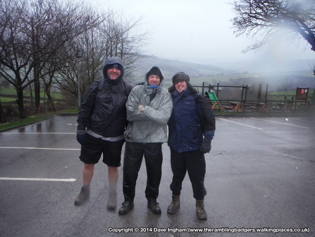
walkers: dave, graham & simon
It was obvious that the weather was going to be a big factor in how enjoyable today’s walk was as the mere sight of the previous night’s forecast had already whittled down the attendees from an initial 11 to a paltry 3. Those three hardy souls were Beaky, Sherpa G-String and me, Sir Edmund Badger. It is fair to say that when we reached our destination in High Bradfield and stepped out of the car that all three of us questioned what on earth we were doing, if only for a split second. The wind was blowing a gale and the rain was only just a notch below frozen which meant every drop that slapped into my face stung for a few seconds afterwards. We checked the map and planned for all eventualities, including where we may cut the walk short should we feel the need to abandon. We don’t like to admit defeat but not at the expense of our safety and common sense is normally applied, apart from my choice of shorts 🙂
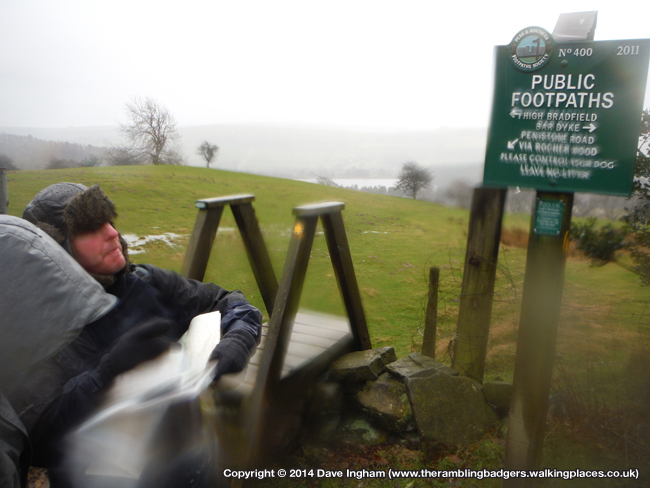
 After a false start due to G being unable to get his gloves on we began the day with a climb towards the first of two intended trig points. A few yards up the road we spotted the footpath sign and climbed over the wall onto a sodden path which would lead us away from the village and onto the open hillside. The amount of rain that had fallen and continued to do so meant there were streams of water everywhere and whilst some would no doubt be there most of the year others were certainly surface water running away.
 By this early stage my feet were already drenched or at least it felt that way as my socks soaked up the rain running down my legs. My hands had warmed up now the blood was flowing which was a good sign. The strong wind was behind us too which helped push me forwards on a couple of occasions. The journey across the open fields would certainly have been much harder work had the wind been in our faces.

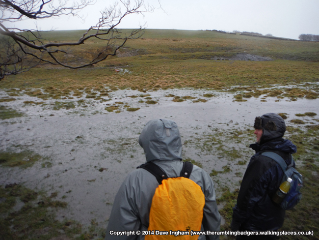
 As the terrain levelled out a little we reached a small road which we crossed no problem before climbing the stone stile built into the wall to enter the next field. We were confronted with a flood. Not massive in the grand scheme of things but there was certainly no way around it, so through it we went. It didn’t matter to me if the water came over the top of my boots as my feet were already wet, but fortunately we managed to plot a path across the water and reach relatively dry land.
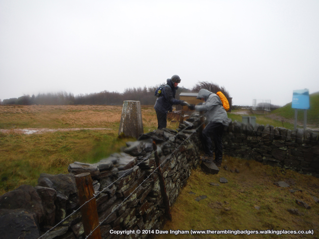
 Even though we were less than half an hour in we were almost at the first trig, Kirk Edge. The terrain became a little steeper although I was given a nudge along by a couple of strong gusts of wind which was nice. Soon the trig came into view tucked away behind a wall and we made our way over. We scaled the wall even though there was a ladder stile a little further along, but that looked to lead into another field which would have meant scaling that wall. With all three of us safely over we took our pictures, had a little chuckle at the madness of it all, then headed off once again for the longer journey to Emlin Ridge.
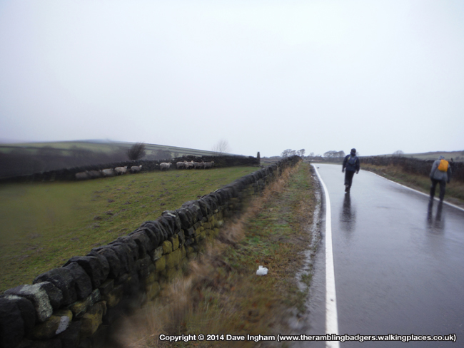
 The next part of our walk was road walking which I can’t say I minded as it was certainly easier than slipping around in mud. We made decent progress along Onesacre Road, turning left at the ned back towards High Bradfield then right onto Penistone Road. The wind was now directly in our faces and the rain ceased to be replaced by hail. There wasn’t much chatting going on at this point, it was simply head down to avoid the sting of the hail stones and plod forward. Even the sheep that were lined up behind a wall seemed to have puzzled expressions as we went past. Thankfully after five minutes the hail stone relented and the rain returned, never in my life have I been so glad to see rain!
 A little further on we turned off the road and joined a track complete with running stream and followed it around Rocher Wood before descending down towards Rocher Head. The path down was slippery in places and I took extra care to make sure I had full grip before transferring all my weight across. For the most part this technique worked well although I didn’t nearly come down at one point.
 We reached a fork of paths and had to pause for a quick map check to ensure we didn’t go wrong. The path to the right would climb up towards Penistone Road which we didn’t want to do, so onwards it was. The route ahead resembled a stream rather than a track which meant even more water in my boots, not that I cared any more. My feet still felt ok even though they were soaked so I wasn’t too concerned about blisters. I know damp, sweaty feet are perfect conditions for blisters to form but maybe they were so wet it just didn’t matter?!
 With our stretch of walking on/in water over, we joined Agden Side Road for a while and once again I was thankful to be on a sound surface. Across the valley we could see Emlin Ridge and I asked the boys to pose for a quick photo before we carried on once more as the road headed downwards.
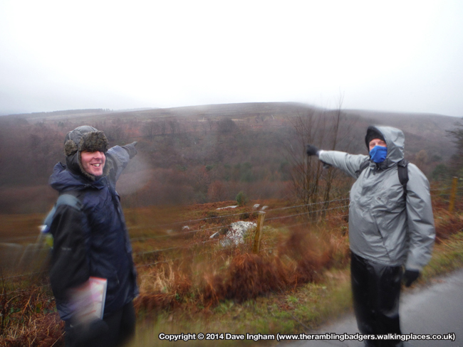
 It was at this point we were passed by a couple of joggers and we exchange pleasantries but at the same time probably thinking the others were mad for being out in these weather conditions. As the road reached its low point it a bridge took us over Agden Dike which only just seemed to be coping with the recent deluge.
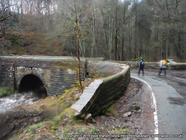
 The descent prior to the bridge was followed by the inevitable climb and we set about five minutes of hard work. Beaky led the way with G a few yards behind and me a similar distance back in third, and I was determined not to lose ground as I usually do when our walks go uphill. Sometimes if I know L’Autobus are behind me I can walk slower and make the climb easier by doing it with them. Today though I didn’t have that luxury and I managed to keep up with the other two, although I was a little please when the road started to level off. We stopped to check the map and GPS to work out where would be best to head for our second trig. We agreed that we should walk another 50 yards or so before climbing the fence and making our way through the heather to Emlin Ridge trig point.
 Heather may look nice but it is a nightmare to walk through and the last few hundred yards seemed to take an age. By now Beaky had long gone and could be seen waiting at the trig as myself and G chose slightly different route to reach our destination. When we did get there the wind was howling and driving the rain horizontal so we took some quick snaps and headed back for the road. Things were instantly better as we now had the wind to our backs but even so I vowed never to return to Emlin Ridge and I can’t think of many places I have said the same thing. In reality I will return at some point as Leanne will want to tick of the trig so as Arnie said, “I’ll be back”, hopefully in nicer conditions 😉
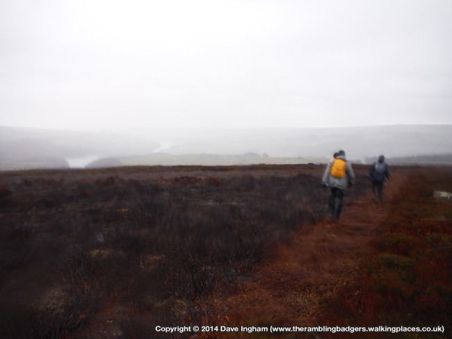

 By this point we were alongside Agden Reservoir and had one eye on the nice warm pub and the nice cool beer that it served. As we reached the head of the reservoir we spotted a path that went through a wall and to the side of the water which appealed to us. Upon closer inspection it didn’t really seem to go anywhere, or certainly not where we wanted to be so we came back to the road and carried on for a little while longer. It was then we spotted a gate to a path that would allow us to walk across the dam which would cut off a little bit of our journey and be scenic at the same time. One problem was the gate was padlocked shut, but that was soon overcome by a little climbing and we were on our way once again. We could see warning signs preventing swimming and other such things but nowhere did we see anything saying we shouldn’t be there, so on we went.

 It wasn’t until we reached the other end and scaled the wall that we found a sign saying there was no unauthorised access. Our general feeling was one of three naughty boys who had done something they shouldn’t, but we were being intentionally wrong. All we wanted to do was save 15 minutes and get back to the pub to dry off!
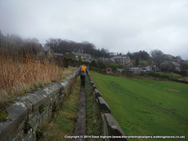
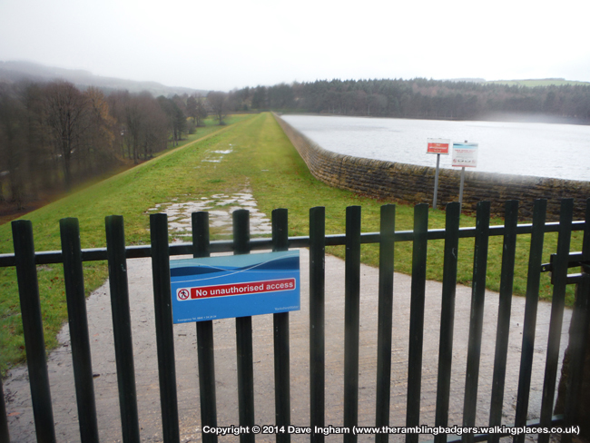 After taking the shortcut across the dam we picked up a footpath that climbed reasonably steeply up towards High Bradfield. It was slippery in places and I was careful with my footing when placing my boots into the soft mud. A few miles earlier I had kept up with the other two during the climb towards the second trig but there was no keeping up this time. Beaky was long gone and G was trying to keep up leaving me a fair distance back. They waited for me as the path levelled a little and from this point we could see across the last field to the village and more importantly the pub.
 We headed over the grass to the corner of the church yard where a narrow path took us around the church and out onto a cobbled street. There was only yards left now and we reach the car just before midday. After a brief attempt to get changed in the car park I gave up and opted for the pub toilets where I could dry off. The pint went down well and as we slowly warmed up I realised how much I had enjoyed today. The weather was atrocious but I was pleased we had turned up and walked as planned. That is what we used to do in the good old days of 2010, and I was pleased to see we hadn’t gone soft, after all, it is only a bit of water. 🙂
Sir Edmund


Recent Comments